Why LiDAR matters for production AI
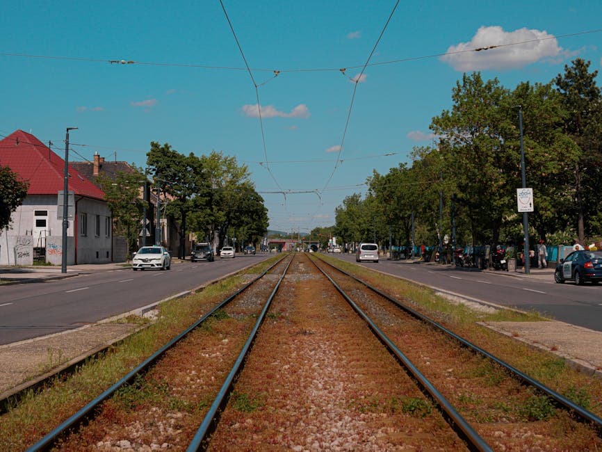
LiDAR (Light Detection and Ranging) sensors emit laser pulses and measure the time-of-flight before each pulse returns, producing dense 3D maps of the environment as point clouds containing millions of measured points per scan. Unlike cameras, LiDAR is largely unaffected by ambient lighting conditions and provides direct depth information at the sensor level rather than inferring it from stereo or motion cues.
These properties are why LiDAR is the primary perception sensor on most production autonomous-vehicle stacks (alongside cameras and radar for sensor-fusion), the dominant sensor in industrial robotics for object manipulation and warehouse navigation, the workhorse of high-definition mapping for road and rail networks, and an increasingly common modality in drone-mounted inspection of bridges, utility infrastructure, agricultural land, and forestry assets.
The annotation work that supports LiDAR-based AI is materially harder than the image-annotation equivalent. Point clouds are sparse at distance, occluded by intervening objects, sensor-specific in their coverage pattern, and dense enough that fully manual annotation is operationally infeasible. The defensible pattern combines pre-trained model-assisted annotation with senior-reviewer correction, applied through tooling specifically built for 3D interaction.
What is a point cloud, structurally
A point cloud is a collection of data points in 3D space, each defined by X, Y, Z coordinates relative to the sensor coordinate frame. High-density automotive LiDAR sensors typically produce 100,000 to 2,000,000 points per scan, with scan rates of 10–25 Hz, producing 1–50 million points per second sustained. Each point may also carry intensity (reflectivity, useful for distinguishing painted lane markings from asphalt), timestamp (essential for handling rolling-shutter effects across the sweep), and on multi-return LiDAR, multiple-return indicator (the first hit vs second hit vs final hit, useful for vegetation penetration and inspection work).
The structural implication for annotation is that the raw data is unstructured: there is no fixed grid, no neighbouring-pixel relationship, and no canonical "view" from which to label the scene. Annotators interact with the cloud through 3D viewers that allow rotation, slicing, projection to camera coordinates, and overlay with the corresponding RGB frames (when camera-LiDAR fusion is part of the engagement). The annotation tool's rendering performance directly affects annotator productivity – a tool that struggles to render 2 million points smoothly burns annotator time on tool friction rather than annotation work.
3D bounding box annotation
The most common 3D annotation task is fitting a 3D bounding box around each object in the scene. The box is defined by its centre position (X, Y, Z in world coordinates), dimensions (length, width, height), orientation angle (yaw, optionally pitch and roll for fine-grained work), and class label. The box has to align with the object's heading direction, not with the sensor coordinate frame – a car's bounding box must point in the direction the car is facing, even if the car is at a 30-degree angle relative to the sensor.
This orientation requirement is what makes 3D annotation materially harder than 2D. The annotator has to manipulate the box from multiple viewing angles simultaneously, typically using a combination of top-down (bird's-eye) view, side projection, and front projection, with the camera image overlaid where camera-LiDAR fusion is available. Defensible 3D-annotation tooling supports all four views simultaneously and lets the annotator adjust box parameters from any of them with real-time updates in the others.
For autonomous-driving and robotics programmes, the standard class set is vehicles (further sub-classified into car, truck, bus, motorcycle, bicycle), pedestrians, cyclists, animals, and dynamic obstacles. The class taxonomy is calibrated against what the downstream perception model needs to distinguish – combining classes that the model treats identically wastes annotation effort; splitting classes the model cannot reliably separate produces noisy training data.
Semantic segmentation of point clouds
Semantic segmentation assigns a class label to every point in the cloud – road surface, sidewalk, building, vegetation, vehicle, pedestrian, cyclist, traffic sign, traffic light, road furniture (signs, poles, barriers), and so on. The output is a per-point class map that supports HD-map production, terrain analysis, road-surface condition assessment, and the broader class of scene-understanding models that need pixel-level (or rather point-level) scene composition rather than just discrete-object detection.
Point-level semantic segmentation is computationally and ergonomically demanding because the data is dense. A single LiDAR scan with 200,000 points cannot be manually classified point-by-point at any defensible cost. The standard pattern is model-assisted pre-labelling: a pre-trained semantic-segmentation model produces initial class assignments for every point, and human annotators review and correct, focusing on the cases where the model is uncertain or the class boundary is ambiguous.
The principal quality concerns are class-boundary precision (at the boundary between road and sidewalk, between vegetation and building, between vehicle and ground) and rare-class coverage. Defensible programmes report per-class IoU on point-level segmentation with explicit attention to the rare classes (pedestrians on sidewalks, cyclists in traffic, road furniture, animals) that matter disproportionately to model performance in production.
Instance segmentation and multi-frame tracking
Instance segmentation extends point-level semantic segmentation with per-object identity: each point assigned to a vehicle is also assigned to a specific vehicle ID, so two adjacent vehicles in the scene have distinguishable point sets even though they share the same semantic class. Instance segmentation is required for crowd analysis, multi-object tracking, traffic-flow modelling, and the broader class of perception models that need to reason about individual objects rather than aggregate scene composition.
Multi-frame tracking is the temporal extension of instance annotation: maintaining consistent object IDs across consecutive LiDAR scans as the sensor moves and the scene evolves. The annotator has to reason about object trajectories in 3D space, handle occlusion (an object hidden behind a building for several frames must re-emerge with the same ID), and detect identity swaps where the tracker has reassigned the wrong ID. The QA artefact that catches tracking failures is the per-track audit across multi-frame sequences, not random-frame audit – which mirrors the same pattern in 2D video annotation.
Applications beyond automotive
LiDAR annotation extends well past self-driving stacks into a range of industrial and infrastructure domains where the same techniques apply but the class taxonomy and the operational pattern differ.
- Construction and surveying: annotating building structures, terrain features, site equipment, and progress milestones from drone-mounted or tripod-mounted LiDAR. Class taxonomy includes wall, roof, opening, structural-steel, soil, equipment, and the construction-specific obstacles that excavator and crane operators need to model.
- Forestry and agriculture: classifying tree species, canopy density, crop health, and land use from aerial LiDAR. The class taxonomy depends on the regional flora and the specific application; in APAC programmes specifically, rice paddy, palm plantation, and rubber plantation are routine class labels.
- Industrial robotics: labelling parts, bins, workspace boundaries, and obstacles for robot manipulation, pick-and-place, and warehouse navigation. The annotation supports both real-time perception models and digital-twin simulation pipelines.
- Infrastructure inspection: identifying cracks, corrosion, deflection, deformation, and structural anomalies in bridges, pipelines, transmission towers, and utility networks. Often paired with high-resolution RGB photography for fine-detail inspection workflows.
- Indoor mobile robotics: mapping floor plans, static obstacles, and dynamic objects (people, forklifts, AGVs) for warehouse-automation and delivery-robot programmes.
- Cultural heritage and museum digitisation: 3D-scanning artefacts, archaeological sites, and historic architecture for preservation and research. The annotation taxonomy is bespoke per programme.
Sensor-fusion: combining LiDAR with cameras and radar
Production autonomous-driving and robotics stacks rarely operate on LiDAR alone. The standard pattern is sensor fusion: LiDAR for accurate depth and 3D geometry, cameras for fine-grained class identification and reading of text and traffic signs, radar for long-range and adverse-weather robustness. The annotation work has to span all three modalities, with consistent identity assignment across them.
The defensible annotation pattern for sensor-fusion programmes uses a unified labelling tool that displays LiDAR, camera, and radar data simultaneously, with the 3D box, the per-frame 2D camera box, and the radar return all linked to the same object ID. The annotator handles ambiguous cases by switching between modalities – a distant object that is sparse in the LiDAR scan may be clearly visible in the camera, and the camera-side annotation can inform the 3D box geometry.
The principal quality concern in fusion annotation is cross-modal consistency. An object identified as a pedestrian in the camera frame at timestamp T has to be the same pedestrian in the LiDAR scan at the same timestamp, with the same ID. The audit artefact that catches cross-modal failures is the cross-modal consistency report: per-frame audit of how many objects appear in one modality but not in another, and per-object verification that the IDs match across modalities.
Technical challenges in point cloud annotation
Even with mature tooling and a model-assisted pipeline, 3D annotation introduces problems that 2D image annotation never raises:
- Sparsity at distance. LiDAR point density falls off with distance from the sensor. A pedestrian at 10 metres might appear as 200 points; the same pedestrian at 50 metres might appear as 8 points. Distant small objects are materially harder to annotate accurately and produce more annotator-disagreement on the boundary geometry.
- Occlusion and missing points. Objects partially blocked by intervening objects have missing points that annotators must interpolate from context. The defensible decision is to specify in the guideline whether occluded portions are included in the bounding box (typical) or excluded (rarer).
- Sensor-specific coverage patterns. Different LiDAR models have different vertical-angular resolution, different range characteristics, and different sweep patterns. Annotators trained on one sensor's data produce annotation that does not transfer cleanly to another sensor without explicit recalibration.
- Sensor-mount calibration. The annotation has to account for the specific position and orientation of the sensor on the vehicle or platform. A mis-calibrated mount offset produces systematic 3D-box positional error that the audit needs to catch.
- Tool performance constraints. Point-cloud viewers must render millions of points in real-time while supporting complex interaction (rotation, slicing, projection, multi-view linking). Annotator productivity depends heavily on tool performance; a tool that lags during box manipulation burns annotator hours on tool friction rather than annotation work.
- Multi-return ambiguity. On vegetation, glass, and reflective surfaces, LiDAR pulses produce multiple returns per pulse. The schema has to specify whether to use first-return, last-return, or all-returns for annotation, and the annotation tool has to support the chosen convention.
Quality standards for 3D annotation
The quality bar that production autonomous-driving and robotics programmes typically hold their LiDAR datasets to:
- 3D IoU threshold: target 3D IoU > 0.7 for vehicle classes (cars, trucks, buses), > 0.5 for pedestrians and cyclists (smaller objects have higher proportional variance). Safety-critical AV programmes typically target tighter thresholds.
- Orientation accuracy: heading angle error < 10 degrees for vehicles. Critical for motion-prediction models, where a 30-degree heading error produces a materially wrong predicted trajectory.
- Completeness: every object above the minimum size threshold (typically 30 cm largest dimension) must be annotated. Missed objects cause false-negative training signal that is especially dangerous in safety-critical applications.
- Multi-frame consistency: object dimensions (length, width, height) should not vary by more than a few centimetres frame-to-frame for a stationary or slow-moving object. Dimension drift is a calibration signal, not just an annotator-quality signal.
- Per-track audit pass rate: random-sample complete object tracks rather than random frames, verifying ID consistency through every occlusion and re-entry event. The most important video-specific quality artefact.
- Sensor-fusion consistency on cross-modal pipelines: per-frame verification that 3D LiDAR objects, 2D camera boxes, and radar returns all share consistent IDs for the same physical object.
- Per-condition reporting: quality broken out by lighting (day/dusk/night), weather (clear/rain/fog/snow), and scene type (urban/highway/residential). A single global IoU number hides the per-condition reality.
Frequently asked questions
Common questions raised by autonomous-driving, robotics, and infrastructure-AI teams scoping a 3D point cloud annotation programme:
- How much faster is model-assisted 3D annotation than fully manual? Typically 3–5x faster on well-understood domains (highway driving, indoor warehouse, structured urban scenes) where a baseline 3D detector is competent. Speedup compresses to 1.5–2x on harder cases (dense unstructured urban scenes, off-road, sensor-fusion programmes with frequent cross-modal disagreement).
- How do I evaluate a 3D annotation vendor? Run a paid pilot of 100–500 LiDAR scans covering the conditions the production model will encounter. The 3D IoU per class, the per-track audit pass rate, the heading-angle error distribution, and (for fusion programmes) the cross-modal consistency report are the comparable artefacts. A vendor that quotes only a headline IoU number without per-class and per-condition reporting is not running a defensible programme.
- Can synthetic LiDAR substitute for real-world annotation? Partially – synthetic point clouds from physics-based simulators are useful for rare conditions (specific safety scenarios, weather conditions hard to capture in the real world) and for pre-training. The structural limit is that synthetic data inherits the simulator's assumptions about sensor noise, reflection physics, and scene composition. A mixed real-and-synthetic pipeline with documented quality on the real subset is the pattern that holds up under regulator and audit review.
- What annotation tooling should I expect a tier-1 vendor to use? Production-grade 3D annotation tooling supports multi-view linking, model-assisted pre-labelling, multi-frame timeline navigation, RGB-image overlay where camera fusion is available, per-class colour-coding, and configurable QA dashboards. Most tier-1 vendors operate on enterprise platforms (proprietary or licensed); some operate on open-source stacks adapted for the specific engagement.
- What is the typical ramp time for a 3D LiDAR annotation programme? 6–10 weeks end-to-end for a new engagement: 2–3 weeks for guideline development and sensor calibration, 2–3 weeks for annotator onboarding and calibration against the gold panel, 2–3 weeks of half-speed production while quality stabilises, then full ramp. Sensor-fusion programmes typically run 8–12 weeks because of the additional cross-modal calibration cost.