Why robot navigation training data is its own collection problem
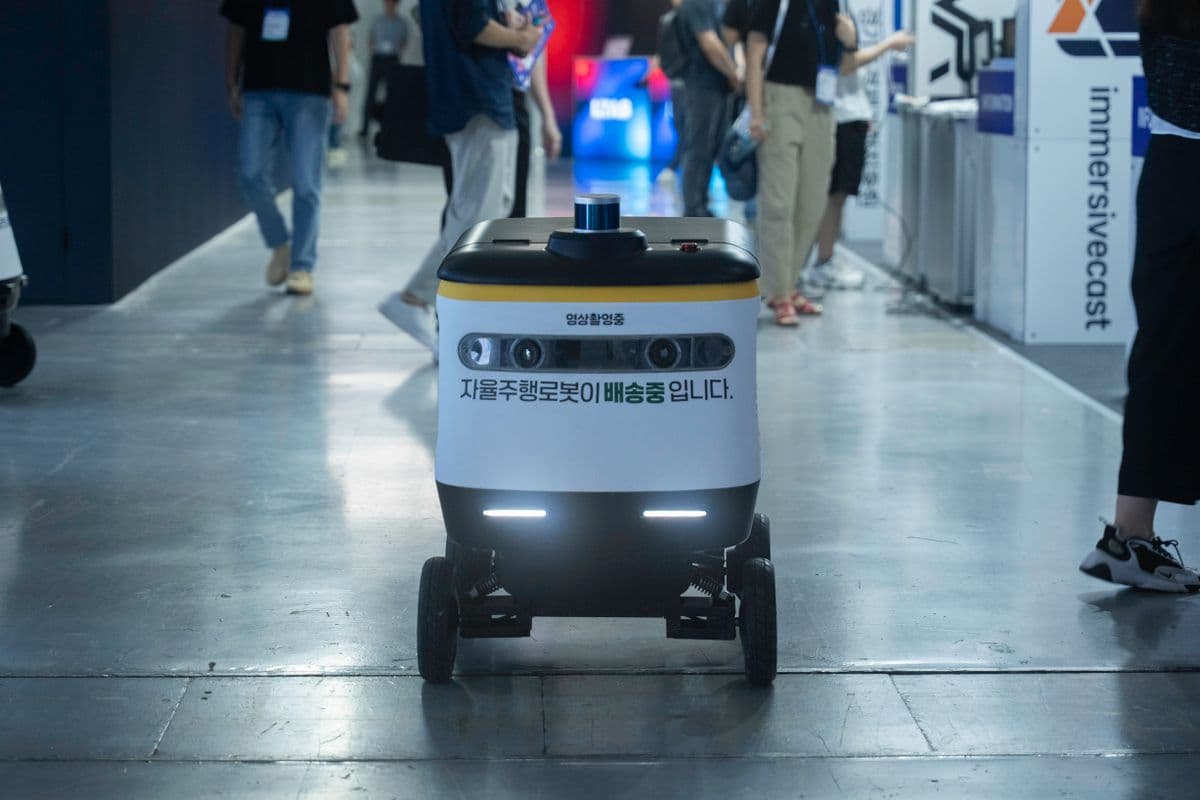
Robot navigation training data is the footage and sensor logs a mobile robot learns to move from: where it can drive, what counts as an obstacle, how pedestrians behave around it, and which command a competent operator would give next. For autonomous mobile robots (AMRs) in warehouses, delivery robots on sidewalks and legged robots on mixed terrain, the model is only as good as the range of places and situations the data covers.
Navigation programs often get scoped as if they were ordinary video collection, and most of the later problems start there. Manipulation data is usually recorded at a fixed workstation where the scene is controlled. Navigation data is recorded while the camera moves through spaces the program does not own, such as public footpaths or a live warehouse aisle, and a frame is only useful if it can be matched to the robot's pose and speed at that instant and to the command it was following. A clean 4K video with no pose or command stream is a perception asset at best, and of little use for policy learning.
For anyone scoping a mobile robot navigation dataset, the expensive mistakes tend to happen in the specification, well before the first route is driven. A camera mounted at the wrong height, or a command stream nobody thought to log, cannot be fixed in post-processing.
What navigation policy and perception teams need from collected footage
Most navigation programs serve two internal customers. Perception teams need diverse, well-exposed imagery they can label for detection, segmentation and traversability. Policy teams, whether they train end-to-end models or learned local planners, need action-labelled trajectories: synchronized sensor observations paired with the velocity or joystick commands that produced the motion. A dataset specified for one team rarely satisfies the other. Agree the split between them before anyone records a route.
Public datasets show the pattern. SCAND, from the University of Texas at Austin, recorded 8.7 hours and 138 trajectories of socially compliant navigation on a Boston Dynamics Spot and a Clearpath Jackal, logging lidar, cameras, odometry, inertial data and the joystick commands of four human operators. The commands are what make it a demonstration dataset rather than a video archive.
Viewpoint is the second decision. On-board cameras, mounted at the robot's actual height and angle with the production lens, see what the deployed model will see, so they carry most of the training value. A chase camera on a follower or at a fixed point behind or beside the robot shows how people react to the robot, and it records near misses and failures in context. Most programs give it a smaller share of hours and use it for evaluation and safety review, plus some interaction labelling.
- On-board RGB, and often stereo or depth, at the deployed camera height, lens and mounting angle
- Wheel or leg odometry and IMU at their native rates, plus GPS or RTK fixes outdoors
- Operator commands (linear and angular velocity, or joystick axes) for every teleoperated segment
- Chase-camera or fixed-camera coverage for pedestrian interaction and incident review
- Per-route metadata: location, time, lighting, weather, crowd density and surface type
Sensor rigs, timing and odometry sync
On a navigation rig, timing matters more than camera resolution. Cameras, IMU, wheel encoders, lidar and GPS run on separate clocks at different rates. If the camera stream drifts 80 milliseconds against odometry, a robot moving at 1.5 metres per second carries 12 centimetres of disagreement between where the image says it is and where the pose says it is. You will not catch that in a video review. It tends to show up much later, as a policy that brakes late.
Production rigs use hardware triggering or a shared time source, such as PTP on the sensor network or GPS-disciplined time outdoors, and log every stream against a common clock. Calibration covers camera intrinsics plus camera-to-IMU and camera-to-lidar extrinsics, and it gets re-checked every time someone touches a mount. The UT Campus Object Dataset (CODa) is a good reference: hardware-synchronized lidar, stereo RGB, RGB-D and 9-DoF IMU, captured over repeated traversals of the same campus routes in different weather and at different times of day.
There are three ways to carry the rig. Collecting on the client's own robot gives the most faithful data but depends on shipping or leasing hardware to the collection site. A proxy platform - a push cart, wheeled base or backpack rig matched to the robot's camera height and field of view - is cheaper and faster to scale, but it produces observations without the target robot's actions. Teleoperating the real robot through the target environments produces the action-labelled data policy teams want. Many programs mix them: proxy rigs for perception breadth, the real robot for a smaller volume of policy demonstrations.
Environment types and what to capture in each
Environment type changes almost every capture decision, from sensor choice to how much chase-camera footage is worth paying for. The table summarizes the three environment families most navigation programs cover, plus the transition zones between them that are easy to forget.
Navigation environment types compared: what to capture and where programs usually fall short
| Environment | Typical robots | Must-capture scenarios | Key sensors beyond RGB | Common gap |
|---|---|---|---|---|
| Indoor warehouse and fulfilment centre | AMRs, autonomous forklifts, tuggers | Forklift crossings, blocked aisles, overhanging pallets, workers stepping out from end caps | Wheel odometry, IMU, 2D or 3D lidar | Recorded on quiet shifts only, missing peak congestion |
| Sidewalk and campus | Delivery robots, service robots | Crowds, crossings, kerb ramps, cyclists and e-scooters on footpaths | IMU, RTK GPS, stereo or 3D lidar | Daytime, dry weather and a single city |
| Mixed and off-road terrain | Legged robots, all-terrain and agricultural platforms | Grass, gravel, mud, slopes, stairs, vegetation that looks solid but is not | High-rate IMU, leg or wheel odometry, lidar or depth | No proprioceptive signal to learn traversability from |
| Indoor-outdoor transitions | Delivery and service robots, legged robots | Doors, lifts, ramps, lobby glass, exposure jumps at entrances | IMU, GPS dropout handling, HDR-capable cameras | Treated as an afterthought, so GPS loss and exposure shifts go untested |
1. Indoor warehouses and fulfilment centres - AMR training data
Warehouses look structured. The aisles repeat and the floors are flat and evenly lit, which is exactly why teams under-collect them. The failures come from everything else: a forklift reversing out of a cross-aisle, shrink-wrap trailing across the floor, a picker kneeling below the lidar plane, reflective floor tape that confuses depth. AMR training data needs to capture those interruptions at the rate they occur on a busy shift, not the rate they occur at 6am on a Sunday.
Plan collection across shift patterns and seasonal peaks, and log which zones were active. Racking and staging areas move, so re-record the same routes whenever the layout changes. Chase-camera footage is worth less indoors than outdoors; a few fixed overhead cameras at intersections usually give better interaction coverage per hour spent. The facility sets the real schedule: site access and safety induction take time, as does working around live forklifts, so agree all of it before the program starts.
2. Sidewalks, campuses and last-mile routes - delivery robots among pedestrians
Pedestrian interaction data matters most on sidewalks. Delivery robots share footpaths with people who stop suddenly or walk in groups, some with prams or dogs, and the way they step around a robot is something simulators predict poorly. The capture plan needs deliberate coverage of each crowd density band, from empty footpaths to congested ones, plus the moments where the robot has to yield, pass or wait.
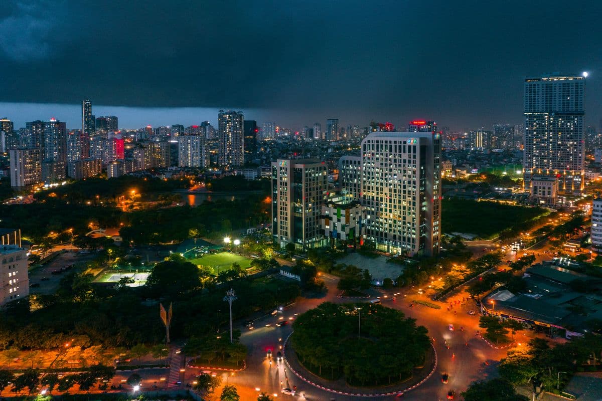
Geography matters more than many teams expect. nuScenes recorded its 1,000 driving scenes in Boston and Singapore, so one dataset contains both right-hand and left-hand traffic. Sidewalk behaviour varies between cities in much the same way. Footpaths in Bangkok, Hanoi or Kuala Lumpur carry parked motorbikes, street vendors and uneven kerbs that a dataset recorded in San Francisco will not contain. If the robot will deploy in APAC cities, collect in them.
Outdoor programs also carry a privacy burden that indoor programs mostly avoid. Faces and licence plates appear in almost every frame. Before anyone films, the program needs a documented position on signage and local permits, plus written rules on blurring before delivery and on retention. Leaving it until delivery is too late.
3. Mixed terrain and indoor-outdoor transitions - legged and all-terrain robots
Legged robots and all-terrain platforms need to learn traversability, which vision alone cannot label. Tall grass and a hedge look similar in RGB; one can be walked through and one cannot. Useful datasets pair camera and lidar with proprioceptive signals such as IMU, joint or leg odometry, wheel slip and shock travel, so a model learns what terrain feels like as well as how it looks. TartanDrive, from Carnegie Mellon University, took this approach for off-road driving, logging roughly 200,000 interactions on a modified ATV with seven sensing modalities.
GND, from the University of Maryland and George Mason University, works at campus scale. It covers over 11 hours across ten university campuses, recorded with lidar, IMU and GPS plus RGB and 360-degree cameras, and maps the ground into five traversability categories (pedestrian walkways, vehicle roadways, stairs, off-road terrain and obstacles). A commercial program can borrow a similar category scheme and add terrain classes specific to its deployment site.
Transitions deserve their own quota. The moments where a robot passes through a door, enters a lift, climbs a ramp or crosses from shade into full sun are short, so they end up badly under-represented if you only log continuous routes. Script them instead: a fixed number of passes per doorway type and lighting condition, recorded on purpose.
Route design, pedestrian interaction and edge-case coverage
Hour count is a poor measure of a navigation dataset. Two hundred hours of the same loop in fine weather adds less than twenty hours designed against a coverage matrix. The matrix should list environment, route, time-of-day band (day, dusk, night, artificial light), weather (dry, wet, heavy rain where relevant), crowd density band and surface type, with a target number of minutes or passes for each cell.
Edge cases need explicit quotas too, or the rare ones barely appear. On the people side: someone stepping out from behind an occlusion, a group that does not part, children or pets, cyclists or e-scooter riders on the footpath, wheelchairs and prams. On the environment side: temporary signage or roadworks, glass and mirrors, puddles with wet reflections, objects moving toward the robot. Some can be staged with consenting participants on private sites. Others only appear in real traffic and need longer capture windows to sample.
Teleoperated segments carry a different risk, which is that the policy learns each operator's habits. Operators should drive the way the deployed robot is meant to behave (yielding distance, passing side, speed near people) rather than however they would drive on their own. SCAND used four operators; commercial programs usually want more, with a written driving guideline and periodic review of each operator's traces. Simulation can fill part of the gap for rare events, but pedestrian behaviour is one of the areas where synthetic data transfers worst.
Specifying a navigation video data collection program
Most scoping delays trace back to the questions in the checklist below. Two cause the most rework when left vague: the time-sync tolerance between streams and the delivery format. MCAP is a sensible default for new programs. It is a serialization-agnostic container for timestamped multi-channel logs, and it is also the default log format in ROS 2, which means it opens in standard tooling without custom converters. Policy teams often want a second copy converted and segmented into episodes.
A managed vendor turns that specification into a capture protocol and proves it in a pilot run at production standards. At DataX Power, mobile navigation video is one of four capture modes. It covers on-board and chase-camera footage across warehouses, outdoor terrain and mixed environments, and it includes pedestrian interaction and obstacle avoidance as well as edge cases. We usually return a pilot specification within five business days and onboard programs in about two weeks. We handle hardware and participants, consent, QA and delivery end to end. Each batch is checked by QA engineers trained on robotics video for temporal consistency and frame quality as well as task coverage. Programs scale from 100-hour pilots to 50,000-hour production on the same contract, drawing on participant networks in Vietnam, Thailand, Singapore and Malaysia.
- Consumers and use: perception labels, policy demonstrations, evaluation sets, or a defined mix by hours
- Platform: client robot, proxy rig matched to camera height and field of view, or both
- Sensor list with rates, resolution, time-sync method and acceptable skew between streams
- Coverage matrix: environments, routes, lighting, weather, crowd bands and edge-case quotas
- Operator driving guideline for teleoperated segments
- Privacy handling: blurring, signage, permits, retention and cross-border transfer
- Delivery format: ROS 1 bags, ROS 2 bags in MCAP, or converted episodes in HDF5, RLDS or LeRobot format, plus folder structure and metadata schema
- QA acceptance: sync checks, frame-drop limits, exposure thresholds and coverage reporting per batch
DataX Power runs managed mobile navigation video collection for AMR, delivery robot and legged robot teams. We capture on-board and chase-camera footage in warehouses, on sidewalks and over mixed terrain, keep the sensor logs synced, and deliver in your format.
See our managed data collection serviceFrequently asked questions about robot navigation training data
Robotics and data leads raise these most often when scoping a navigation collection program.
- How many hours of robot navigation training data does a program need?
- There is no fixed number, because coverage matters more than volume. As a practical estimate, a single-site AMR perception program can produce useful results from 100-300 hours, provided those hours are spread across shifts and layouts and cover both quiet and congested periods. Multi-city sidewalk programs and legged-robot traversability programs usually need 1,000 hours or more to cover the combinations of weather, lighting and terrain. Start with a 100-hour pilot. Train on it, then use the failure analysis to set production quotas.
- What delivery format should we request for a mobile robot navigation dataset?
- For raw logs, ROS 2 bags in MCAP are the safest default, because MCAP is the default ROS 2 log format and works with standard tools. ROS 1 bag files remain an option for older stacks. If the data will feed imitation learning, also request an episode-segmented copy in HDF5, RLDS or LeRobot format with a documented metadata schema, and validate both formats during the pilot.
- How much does navigation video data collection cost?
- As a DataX Power practical estimate consistent with our published cost ranges, camera-only on-board capture sits close to egocentric program rates of roughly $80-$200 per captured hour, while synchronized multi-sensor rigs with lidar, IMU and RTK GPS fall in the $200-$450 range. Costs move toward the top of each range when the program needs site access and permits, night or wet-weather capture, or teleoperated segments with trained operators. Annotation is priced separately.
- Can public datasets like SCAND, CODa or GND replace collecting our own navigation data?
- They are useful for pre-training and benchmarking but rarely sufficient for deployment. These datasets were recorded on specific research robots, mostly on university campuses in the United States, and their licences need checking before commercial use. A robot deploying in a Singapore mall or a Thai distribution centre needs data from comparable environments, captured with its own camera geometry and under terms the company controls.
- How is privacy handled when recording navigation video in public spaces?
- Privacy belongs in the specification. Common measures start with signage and site permissions where required and consent from participants in staged scenarios. Faces and licence plates are blurred automatically before delivery, and footage sits in access-controlled storage for an agreed retention period. For programs in Singapore, Malaysia or Thailand the relevant PDPA rules apply, and programs linked to the EU may also need GDPR controls on transfer and processing.